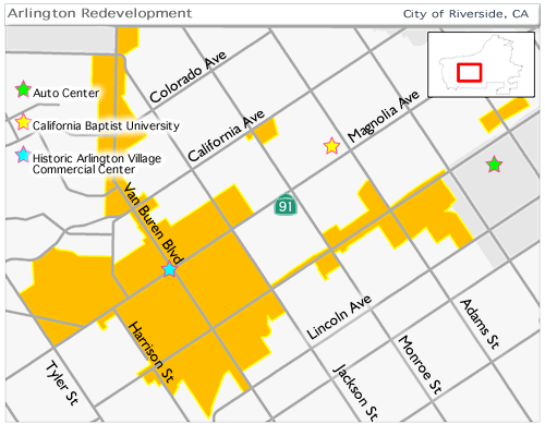
Arlington Project Area
Contains: 1,235 acres
Established: November 28, 1978
Land Uses: rimarily residential and commercial straddling State Highway 91
Includes: Portion of the Riverside Auto Center
Located:Southwest portion of the City in Wards 3, 4, 5 and 6
Map: Aerial Map
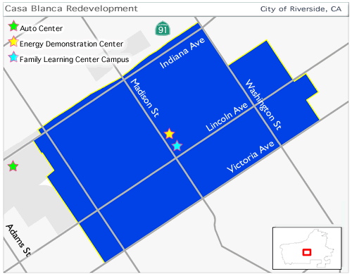
Casa Blanca Project Area
Contains: 725 acres
Established: November 9, 1976
Land Uses: Primarily residential and industrial and adjacent to State Highway 91
Includes: Portion of the Riverside Auto Center
Located:South central portion of the City in Ward 4
Map: Aerial Map
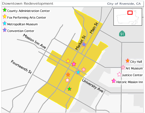
Downtown Project Area
Contains: 700 acres
Established: November 16, 1971, the longest established existing Project Area
Land Uses: Primarily institutional, commercial, office and some industrial adjacent to State Highways 60 and 91
Includes: Historic downtown, landmark historic structures, the Mission Inn, Fox Theater Performing Arts Center, as well as the Riverside Convention Center, City Hall, County Administrative and Justice Centers, and Riverside Community Hospital
Located:Northwestern portion of the City in Ward 1
Other: Merged with the Airport Project Area
Map: Aerial Map
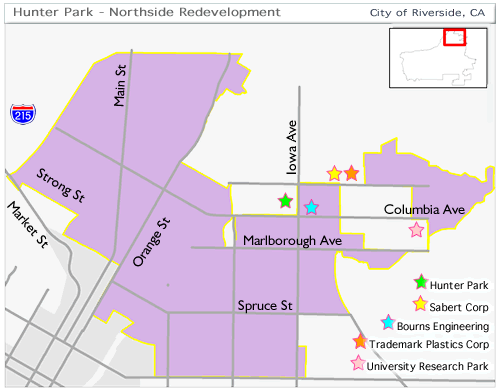
Hunter Park/Northside Project Area
Contains: 2,636 acres
Established: June 24, 2003
Land Uses: Primarily industrial with some office and commercial and straddles State Highways 60 and 91 and Interstate 215
Located: Northern portion of the City in Ward 1
Map: Aerial Map
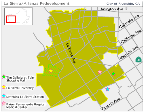
La Sierra/Arlanza Project Area
Contains: 6,424 acres, the largest Project Area
Established: July 13, 2004, the newest Project Area
Land Uses: Primarily residential with some commercial and limited industrial and straddles State Highway 91
Includes: La Sierra University and The Galleria at Tyler regional shopping center
Located:Southwest portion of the City in Wards 5, 6 and 7
Map: Aerial Map
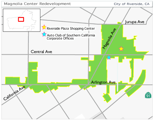
Magnolia Center Project Area
Contains: 475 acres, the smallest Project Area
Established: July 14, 1998
Land Uses: Primarily commercial and office with some residential and straddles State Route 91
Includes: Riverside Plaza regional shopping center
Located:: Center of the City in Wards 3 and 4
Map: Aerial Map
Sycamore Canyon Project Area
Contains: 1,334 acres
Established: December 20, 1983
Land Uses: Primarily industrial and office and straddles Interstate 215 and includes a portion of Sycamore Canyon Regional Park
Includes: Eastern portion of the City in Ward 2
Located:Merged with the University Corridor Project Area
Map: Aerial Map

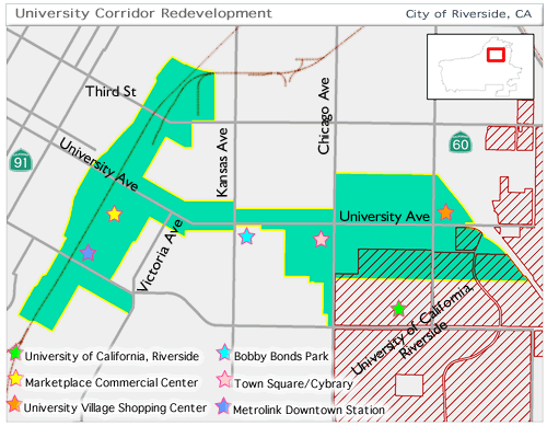
University Corridor Project Area
Contains: 1,012 acres
Established: October 25, 1977
Land Uses: Mixed residential, institutional, commercial, and industrial and is adjacent to State Routes 60 and 91 and Interstate 215 immediately west and north of the University of California, Riverside
Includes: Downtown Metrolink Station
Located:North center portion of the City in Ward 1 and 2
Other:Merged with the Sycamore Canyon Project Area
Map: Aerial Map